
Navionics EU646L Large Chart | Central & West Europe | 4Boats
Navionics EU646L Large Chart | Central & West Europe | 4Boats
4Boats
Couldn't load pickup availability
Description
Description
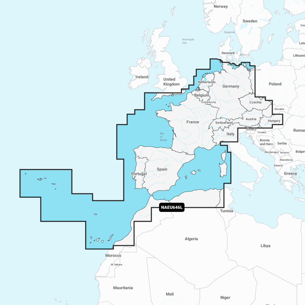
EU646L Large Chart for Central & West Europe provides detailed nautical data and advanced navigation tools for coastal and offshore boating across central and western Europe, presented in an easy-to-read, familiar chart display.
- Nautical Chart: Comprehensive charts derived from multiple official government and private sources, displayed in a familiar look and feel.
- SonarChart: Innovative 1' (0.5 m) bathymetry charts created using Navionics proprietary systems.
- Community Edits: Local knowledge from edits made by users of the Navionics Boating app.
- Daily Updates: Up to 5,000 updates to our charts every day.
- The Navionics subscription: A one-year subscription to Daily Updates and advanced features is included with this product; renewals available at a discounted price.
-
Subscription advanced features:
- Dock-to-dock Autorouting - start your trip with a suggested route.
- Advanced Map Options - customise your view.
- Plotter Sync - plan on mobile, go on plotter.
Coverage suited for coastal cruising and offshore passages across central and western Europe; ideal for recreational and professional mariners who need up-to-date charts and advanced routing tools.